Fixed-box method
Overview
The fixed-box tracker (tracking_method: "fixed_box") defines a time-independent analysis center.
At all time steps, FrameIt uses the same grid point as the cyclone center, computed once from a user-defined geographic location.
This option is useful when:
the region of interest is fixed (site-focused diagnostics),
tracking variables (MSLP, winds) are not available or not reliable.
Inputs and outputs
Input dataset
The model dataset must provide:
a time coordinate named
time,latitude and longitude coordinates, either: - 1D latitude and 1D longitude (typical AROME-like rectilinear grid), or - 2D latitude and 2D longitude (typical Meso-NH curvilinear grid).
Configuration
Minimal configuration
tracking_method: "fixed_box"

# Fixed center location, [lat, lon] in degrees
fix_subdomain_center: [-17.5, 60.0]
Optional (recommended) parameters
# Atmospheric model identifier used to interpret the latitude/longitude geometry
atm_model: "AROME"     # or "MNH"
Key definitions
tracking_methodMust be set to
"fixed_box".fix_subdomain_centerFixed center location given as
[lat, lon](degrees).
Algorithm
Step 1, read the fixed target location
The tracker reads the target point from the configuration:
(lat0, lon0) = fix_subdomain_center
Step 2, locate the closest model grid point
FrameIt selects the nearest grid point by minimizing a squared distance in latitude/longitude space.
Rectilinear grid (latitude 1D, longitude 1D)
If latitude and longitude are 1D arrays:
cy = argmin_j (lat[j] - lat0)^2
cx = argmin_i (lon[i] - lon0)^2
Curvilinear grid (latitude 2D, longitude 2D)
If latitude and longitude are 2D arrays:
dist2(j, i) = (lat(j, i) - lat0)^2 + (lon(j, i) - lon0)^2
(cy, cx) = argmin_{j,i} dist2(j, i)
Step 3, build a time-dependent output
The index pair (cy, cx) is repeated for each model timestamp, producing:
cy(time) = constantcx(time) = constant
Practical considerations and limitations
Longitude convention: ensure that the fixed longitude and the dataset longitudes use the same convention (for example
[-180, 180]or[0, 360]). A mismatch can produce an incorrect nearest-point selection.Distance metric: the method uses a squared Euclidean distance in (lat, lon) space, not a true geodesic distance. This is generally adequate for small domains.
Masked coordinates: if latitude/longitude contain NaNs (masked areas), the minimization must avoid all-NaN distance fields. If all candidate distances are NaN, the selection will fail.
Fixed-box versus extraction box: the fixed-box tracker defines the center used by FrameIt. The extraction domain size is controlled separately (for example
x_boxsize_kmandy_boxsize_km).
Example
atm_model: "AROME"
tracking_method: "fixed_box"

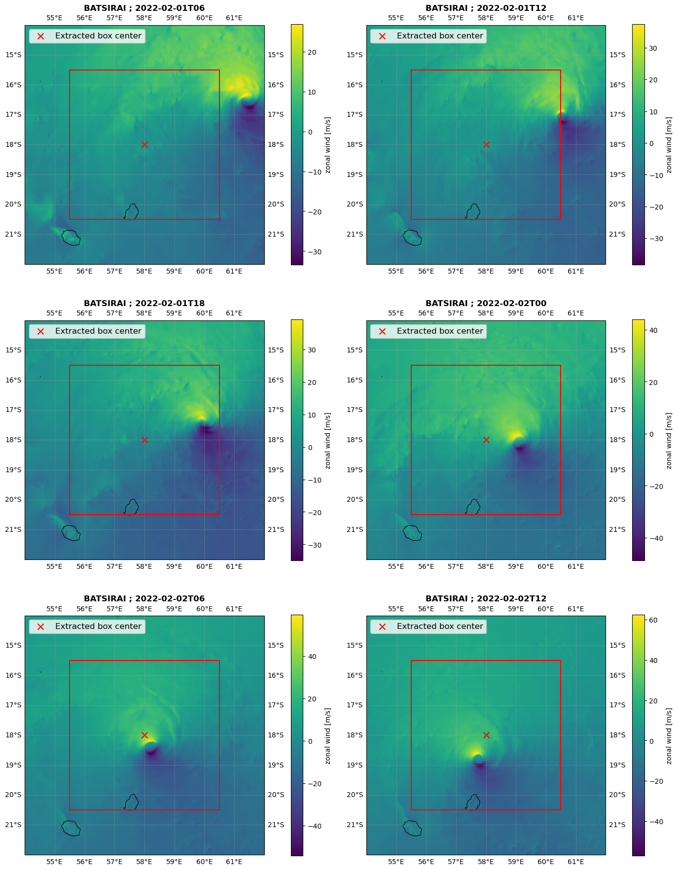
fix_subdomain_center: [-18, 58.0]

x_boxsize_km: 500.0
y_boxsize_km: 500.0
Illustration
Here is an illustration for the tropical cyclone Batsirai, using the fixed box method.