Dataset Summary
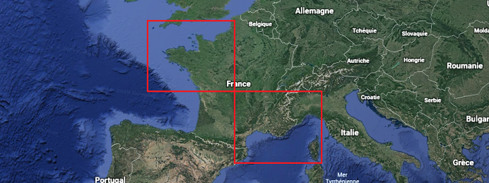
The data cover two geographical zones, North-West and South-East of France, during three years, 2016 to 2018.
The full dataset can be downloaded here (in the repository data).
There, for each geographical zone (/data/NW or SE/) and for the 3 years you will find the following data types :
| Data Type | Size for NW zone (GB) | Size for SE zone (GB) | Total Size (GB) | Path (example for the NW zone) |
|---|---|---|---|---|
| Ground Observation | 0.5 | 2.5 | 3.0 | /data/NW/ground_stations/ |
| Rain Radar | 5.8 | 6.5 | 12.3 | /data/NW/radar/rainfall/ |
| Rain Radar Quality Code | 19.6 | 31 | 50.6 | /data/NW/radar/rainfall_quality_code/ |
| Reflectivity (new product) | 13.5 | 20.0 | 33.5 | /data/NW/radar/reflectivity_new_product/ |
| Reflectivity (old product) | 3.9 | 4.0 | 7.9 | /data/NW/radar/reflectivity_old_product/ |
| Weather models 2D | 25.8 | 23.0 | 48.8 | /data/NW/weather_models/2D_parameters/ |
| Weather models 3D | 7.8 | 8.0 | 15.8 | /data/NW/weather_models/3D_parameters/ |
| Satellite data (CT and 4 channels) | 24 | 22.8 | 46.8 | /data/NW/satellite/ |
| Masks | 0.0004 | 0.0004 | 0.001 | /data/NW/masks/ |
| TOTAL | 100.9 | 117.8 | 218.7 |